


- 👨💻 Ten+ years in the Geospatial sector.
- 🗺️ Expereince with React and Mapbox GL JS/Leaflet integration.
- ✨ Occasionally post as [@getbounds on bluesky.
- 🌐 Check out my getBounds blog for my full portfolio.
- 🎧 Grew up listening to reggae music and once hosted a dancehall radio show.

A simple card layout of upcoming tides and water temperature from NOAA using their open API.

A highly modified version of the NWS Radar using Stamen Toner basemap for easier viewing on a TRMNL device. The United States and Canda only - the areas covered by the NWS radar. The blues and greens tend to blend together - but the yellows - which indicate heavier rain - are marked by angled hashes, and the reds are the darkest color - usually surrounded by yellow/angled hashes.
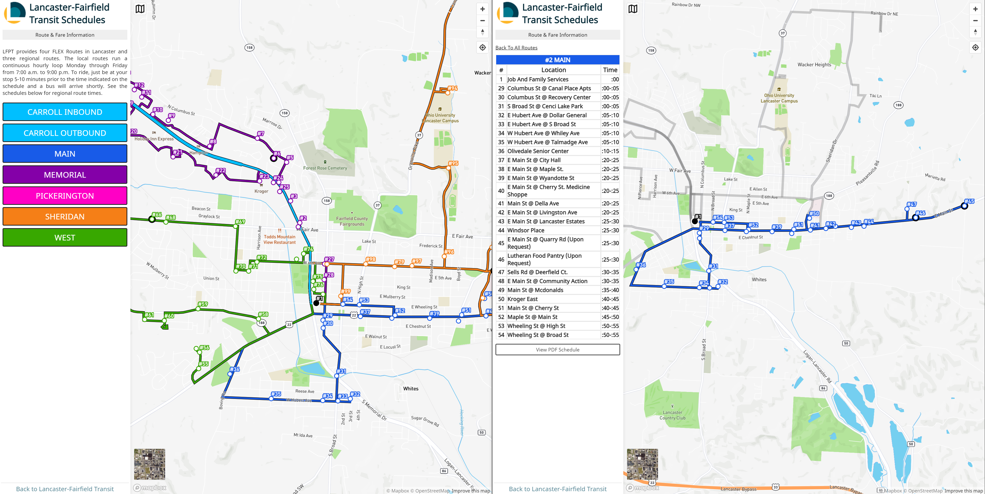 A transit route map for the Lancaster-Fairfield Public Transit.

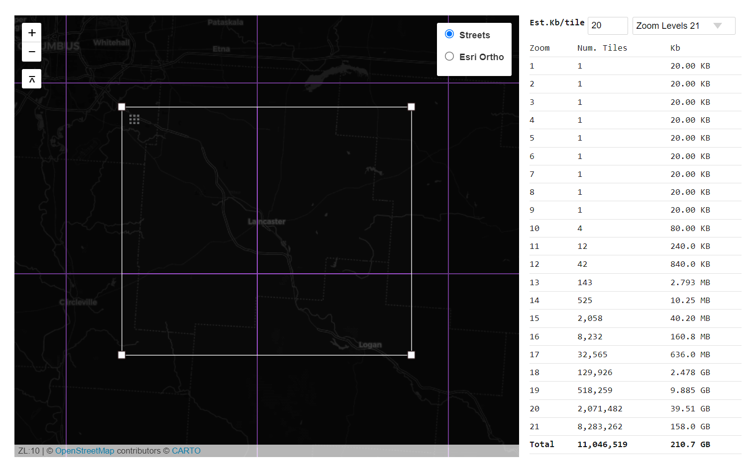 Slippy Map Tile Size Estimator
This tool was adapted from the Tile Calculator (CC-BY ICGCat) by Geostart (@geostarters).
A NodeJS script to download all layers within a public or protected ArcGIS Online Feature or Map Service as GeoJSON.
A tool that queries publicly available elevations for a given set of points and returns the result as an array.
A GeoJSON Network trace tool for simple upstream and downstream network tracing.
A responsive open source store locator built with Leaflet and Bootstrap and based on the original Mapbox JS example.
A layer control for Mapbox GL JS with groups and a filter function.
A simple Mapbox GL JS Story Map template built using the original Mapbox JS example.
A collection (currently 1) of desktop basemap styles for OpenStreetMap.
Open Parcel Viewer - A mobile ready web app for displaying 50k parcels or polygons without needing a GIS server.
A tool to query remote vector tiles and return GeoJSON features, limiting to an optional buffer.
A tool to create vector tiles from the command line. It is essentially automation of geojson2mvt using TurfJS.
WMTS tile server written in NodeJS that serves wmts services, XYZ tiles and tilejson from mbtiles containing vector or raster tiles.
- Palisades Fire Before and After
- Deck GL and 3D Tiles
- Finding Perpendicular lines with TurfJS
- MapCompare
- GeoJSON Network Trace Tool
GitHub portfolio of Malcolm T Meyer