Road Observation and Analysis Dashboard System with AI
About ROADSCAN
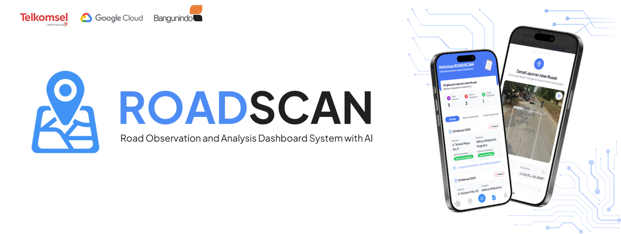
Roadscan (Road Observation and Analysis Dashboard System with AI) is an innovative solution designed to address the challenges associated with road damage monitoring and maintenance in Indonesia. The system leverages Artificial Intelligence (AI) and a data management dashboard to create a more efficient, accurate, and participatory approach for road observation.
The condition of roads is a critical factor for public mobility and safety. Damaged roads not only hinder transportation but also increase the risk of accidents and economic losses. In Indonesia, data from the Ministry of Public Works and Public Housing (PUPR) highlights the severity of road damage, with thousands of kilometers in poor condition. Roadscan responds to this issue by using AI-driven image recognition technology to identify road damage through photos or videos submitted by users. This data is then processed to analyze the type and extent of the damage, helping prioritize repairs based on urgency and location.
The system integrates AI with cloud-based platforms like Vertex AI and Bliv to enhance detection accuracy and operational efficiency. Vertex AI allows for real-time model training and deployment using data collected from users, while Bliv's interactive dashboard helps visualize the results in an accessible format. This solution empowers local governments, infrastructure contractors, and the general public to collaborate effectively in maintaining and improving road conditions.
- Implement YOLOv11 AI Model for automatic detection of road damage.
- Geospatial Mapping: Use data to map road damage locations.
- Enhance Collaboration: Promote community involvement in data collection and validation.
Roadscan offers several advantages:
- It improves road safety by accelerating repair work, reducing accidents, and minimizing vehicle damage.
- It streamlines logistics and reduces transportation costs by ensuring smoother, well-maintained roads.
- It facilitates the integration of AI in infrastructure management and supports data-driven decision-making for better urban planning.
| Name | GitHub | |
|---|---|---|
| Aditya Widiyanto Nugroho | ||
| Fadil Fauzan | ||
| Valiant Alfiansyah |
A collection of road damage datasets used to train the AI model for detecting road conditions.
This repository contains the machine learning models, including the YOLOv11 model for detecting road damage, along with training scripts and pre-trained weights.
Links to design mockups or user interface layouts for the application.